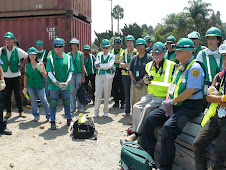
I had a great day today teaching disaster preparedness with my partner and captain and the men and women of the United States Coast Guard.
Thursday, December 18, 2008
Spending the day with the US Coast Guard
I had a great day today teaching disaster preparedness with my partner and captain and the men and women of the United States Coast Guard.Wednesday, December 17, 2008
"Death map" shows heat a big hazard to Americans

(Reprinted from Yahoo)
WASHINGTON (Reuters) – Heat is more likely to kill an American than an earthquake, and thunderstorms kill more than hurricanes do, according to a "death map" published on Tuesday.
Researchers who compiled the county-by-county look at what natural disasters kill Americans said they hope their study will help emergency preparedness officials plan better.
Heat and drought caused 19.6 percent of total deaths from natural hazards, with summer thunderstorms causing 18.8 percent and winter weather causing 18.1 percent, the team at the University of South Carolina found.
Earthquakes, wildfires and hurricanes combined were responsible for fewer than 5 percent of all hazard deaths.
Writing in BioMed Central's International Journal of Health Geographics, they said they hoped to dispel some myths about what the biggest threats to life and limb are.
"According to our results, the answer is heat," Susan Cutter and Kevin Borden of the University of South Carolina wrote in their report, which gathered data from 1970 to 2004.
"I think what most people would think, if you say what is the major cause of death and destruction, they would say hurricanes and earthquakes and flooding," Cutter said in a telephone interview. "They wouldn't say heat."
"What is noteworthy here is that over time, highly destructive, highly publicized, often-catastrophic singular events such as hurricanes and earthquakes are responsible for relatively few deaths when compared to the more frequent, less catastrophic such as heat waves and severe weather," they wrote.
The most dangerous places to live are much of the South, because of the heat risk, the hurricane coasts and the Great Plains states with their severe weather, Cutter said.
The south central United States is also a dangerous area, with floods and tornadoes.
California is relatively safe, they found.
"It illustrates the impact of better building codes in seismically prone areas because the fatalities in earthquakes have gone down from 1900 because things don't collapse on people any more," Cutter said.
"It shows that simple improvements in building codes in high-wind environments like hurricane coasts, and the effectiveness of evacuation in advance of hurricanes, has reduced the mortality from hurricanes and tropical storms," she added.
"So there are some things we are pretty good at in getting people out of harm's way and reducing fatalities."
Cutter said there is no national database on such deaths and this was a first try at getting one together.
Thursday, November 13, 2008
The Great Shakeout...what did you do?
 UCLA Transportation Department
We had a good time today talking about and going through the "DUCK, COVER & HOLD" of what to do during an earthquake. Thank you to all of my UCLA students for your questions and focus during todays drill.
Wednesday, November 12, 2008
Monday, October 13, 2008
Free Download that can save your life.
http://www.cert-la.com/EmergPrepBooklet.pdf
Click on the above link to download a free book that will help you and your family prepare for a disaster.
Click on the above link to download a free book that will help you and your family prepare for a disaster.
Thursday, September 11, 2008
Remembering 9/11


Terrorism is a form of disaster that we need to be aware of. Here is a couple pictures from my trip to New York just after September 11, 2001.
Monday, September 8, 2008
Out with the old/In with the new...it's back to school...here's what to do!
One of the best tips I share with my CERT (Community Emergency Response Team) class members is to recycle item they already own. Minimise spending money, but still get you and your family prepared. As your children, grandchildren, neighbors, kids in church, nieces and nephews head back to school and we buy new school supplies, do not throw away the old backpacks. Take the old backpacks and use them as "GO" bags for your family.
Another tip for your back to school shopping is take advantage of school supplies being on sale and include these items in your families disaster supplies. (notebook, pens, markers, index cards) all of these things can be used for documentation and triage tags.
Another tip for your back to school shopping is take advantage of school supplies being on sale and include these items in your families disaster supplies. (notebook, pens, markers, index cards) all of these things can be used for documentation and triage tags.
Tuesday, September 2, 2008
Jay says: "What do I put in my "GO" bag?"
I am often asked when teaching disaster preparedness... "What do I need to pack and for how long?" The standard teaching use to say 72 hours. In recent years, that 72hours was pushed to 5 days...today I am of the mindset of 1 week/ 7 days. Plan on having supplies for your family to survive 7 days.
The main item for survival is clean, potable drinking water. The equation to use is 1Gx1Px1D...(1 gallon per person per day) Below is a link to click on to print a PDF file from the U.S. Government that is a great guide to get started, but by no means is this list the end-all.
http://www.ready.gov/america/_downloads/checklist.pdf
Good luck, but more important...good preparedness.
Monday, September 1, 2008
A message from Barack Obama regarding Gustav and first responders
Today, the thoughts and prayers of all Americans are with those in the path of Hurricane Gustav -- and many of you are asking what you can do to help. We do not yet know what the impact of Hurricane Gustav will be, and we hope with all our hearts that the damage will not be as great as it was three years ago. But we know there will be damage, and there is something you can do right now. Your financial support will strengthen organizations like the American Red Cross that are evacuating Gulf Coast residents and planning to help communities get back on their feet. Make a donation to support the American Red Cross today. At times like this, it is our compassion and resilience that define who we are as a nation. Please give whatever you can afford, even $10, to make sure the American Red Cross has the resources to help those in the path of this storm: https://donate.barackobama.com/redcross Thank you for your generosity, and I hope you will join Michelle and me in praying for the safety of those in the path of the storm and the first responders who are doing all they can to ensure the safety of their communities.
Barack
Barack
Sunday, August 31, 2008
NEW ORLEANS SET TO BE TESTED
NEW ORLEANS –
With a historic evacuation of nearly 2 million people from the Louisiana coast complete, gun-toting police and National Guardsmen stood watch as rain started to fall on this city's empty streets Sunday night — and even presidential politics took a back seat as the nation waited to see if Hurricane Gustav would be another Katrina.
The storm was set to crash ashore late Monday morning with frightful force, testing the three years of planning and rebuilding that followed Katrina's devastating blow to the Gulf Coast. The storm has already killed at least 94 people on its path through the Caribbean.
Painfully aware of the failings that led to more than 1,600 deaths during Katrina, this time officials moved beyond merely insisting tourists and residents leave south Louisiana. They threatened to put looters behind bars, loaded thousands onto buses and warned that anyone who remained behind would not be rescued.
They were confident that they had done all they could.
"It's amazing. It makes me feel really good that so many people are saying, 'We as Americans, we as the world, have to get this right this time,'" New Orleans Mayor Ray Nagin said late Sunday. "We cannot afford to screw up again."
Col. Mike Edmondson, state police commander, said he believed that 90 percent of the population had fled the Louisiana coast. The exodus of 1.9 million people is the largest evacuation in state history, and thousands more had left from Mississippi, Alabama and flood-prone southeast Texas.
Late Sunday, Gov. Bobby Jindal issued one last plea to the roughly 100,000 people still left on the coast: "If you've not evacuated, please do so. There are still a few hours left."
Louisiana and Mississippi temporarily changed traffic flow so all highway lanes led away from the coast, and cars were packed bumper-to-bumper. Stores and restaurants shut down, hotels closed and windows were boarded up. Some who planned to stay changed their mind at the last second, not willing to risk the worst.
"I was trying to get situated at home. I was trying to get things so it would be halfway safe," said 46-year-old painter Jerry Williams, who showed up at the city's Union Station to catch one of the last buses out of town. "You're torn. Do you leave it and worry about it, or do you stay and worry about living?"
There were frightening comparisons between Gustav and Katrina, which flooded 80 percent of New Orleans. There was no doubt the storm posed a major threat to the partially rebuilt city and the flood-prone coasts of Louisiana and southeast Texas.
Mindful of the potential for disaster, the Republican Party scaled back its normally jubilant convention — set to kick off as Gustav crashed ashore. President Bush said he would skip the convention altogether, and Sen. John McCain visited Jackson, Miss., on Sunday as his campaign rewrote the script for the convention to emphasize a commitment to helping people.
The nation's economic attention was focused on Gustav's effect on refineries and offshore petroleum production rigs. The combination of prolonged production interruptions, such as occurred when Katrina and Rita damaged the Gulf infrastructure, could trigger rising prices.
Billions of dollars were at stake in other wide-ranging economic sectors, including sugar harvesting, the shipping business and tourism. The Mississippi Gaming Commission ordered a dozen casinos to close.
Forecasters said Gustav could strengthen slightly as it marched toward the coast. At 11 p.m. EDT Sunday, the National Hurricane Center said Gustav was centered about 220 miles southeast of New Orleans and was moving northwest near 16 mph. It had top sustained winds of 115 mph, and was likely to stay a Category 3 storm when it made landfall west of New Orleans. Category 3 storms have winds between 111 mph and 130 mph.
Rain started falling in New Orleans before sunset, and tropical storm-force winds had reached the southeastern tip of the state.
New Orleans will likely be on the "dirty" side of the storm — where rainfall is heaviest and tornadoes are possible, but the storm surge is lower. If forecasts hold, the city would experience a storm surge of only 4 to 6 feet, compared to a surge of 10 to 14 feet at the site of landfall, said Corey Walton, a hurricane support meteorologist with the National Hurricane Center. Katrina, by comparison, brought a storm surge of 25 feet.
Surge models suggest large areas of southeast Louisiana, including parts of the greater New Orleans area, could be flooded by several feet of water. But Gustav appears most likely to overwhelm the levees west of the city that have for decades been underfunded and neglected and are years from an update.
Against all warnings, some gambled and decided to face the storm's wrath. On an otherwise deserted commercial block of downtown Lafayette, about 135 miles west of the city, Tim Schooler removed the awnings from his photography studio. He thought about evacuating Sunday before deciding he was better off riding out the storm at home with his wife, Nona.
"There's really no place to go. All the hotels are booked up to Little Rock and beyond," he said. "We're just hoping for the best."
The final train out of New Orleans left with fewer than 100 people on board, while one of the last buses to make the rounds of the city pulled into Union Station empty. Police made final rounds around 7 p.m. Every officer in the department was on duty, and the 1,200 on the street were joined by 1,500 National Guardsmen.
The only sign of life on St. Bernard Avenue — a four-lane artery through the partially rebuilt Gentilly neighborhood that flooded during Katrina — was a brown and black rooster meandering along the street.
"When the 911 calls start coming in, we'll know how many people are left in town," said police superintendent Warren Riley.
Even as they pressed to complete the evacuation, officials insisted there would be no repeat of the inept response to Katrina's wrath. Homeland Security Secretary Michael Chertoff said search and rescue will be the top priority once Gustav passes — high-water vehicles, helicopters and fixed-wing aircraft, Coast Guard cutters and a Navy vessel that is essentially a floating emergency room are posted around the strike zone.
West of New Orleans in Houma, he wished passengers well as stragglers boarded buses for Shreveport and Dallas.
"It's going to be hot on some of the buses. It's going to be a long trip," Chertoff said. "So it's not going to be pleasant, but it's a lot better than sitting in the Superdome and it's a lot better than sitting in your house."
Melissa Lee, who lives in Pearl River, a town near the boundary of Mississippi and Louisiana, was driving away to Florida Sunday. Before she left, she heard neighbors chopping down trees with chain saws, trying to ensure the tall pines that surrounded their homes wouldn't come crashing down.
"I sent my son out with a camera and said, `Go take pictures of our backyard. Because it's going to look different when we get back.'"
Saturday, August 30, 2008
Gustav grows to a Category 4
ReutersHurricane Gustav strengthens near Cuba08.30.08, 2:00 PM ET
United States - * Hurricane Gustav winds climb to 145 mph (230 kph) en route to Cuba
* Storm now Category 4 hurricane on five-step scale
By Jeff Franks
HAVANA, Aug 30 (Reuters) - Hurricane Gustav grew bigger and stronger with 145 mph (230 kph) winds as it roared toward Cuba on Saturday and threatened the oil-rich Gulf of Mexico and New Orleans which was devastated by a similar storm in 2005.
Gustav ripped across the Cayman Islands, closed in on Cuba's Isle of Youth and was set to strike the Cuban mainland.
Forecasters predicted Gustav would cross the Gulf of Mexico and hit central Louisiana on Tuesday with the same force that Hurricane Katrina delivered three years ago.
The U.S. National Hurricane Center said Gustav revved up as it crossed the warm Caribbean and was a Category 4 storm on the five-stage Saffir-Simpson scale of hurricane intensity.
Any storm with winds of at least 111 mph (178 kph) is ranked "major" by the Miami-based hurricane center.
"Plain and simple, Gustav is forecast to be a large and powerful hurricane in the Gulf of Mexico, headed toward the northern Gulf coast," said Richard Knabb, a senior hurricane specialist a the U.S. National Hurricane Center.
Gustav could strengthen further before crossing on Sunday into the Gulf of Mexico, where offshore platforms produce 25 percent of U.S. oil and 15 percent of its natural gas.
Gustav was expected to dump up to 12 inches (30 cm) of rain as it crossed Cuba.
The storm's center was 55 miles (85 km) southeast of the Isle of Youth and 185 miles (295 km) from Cuba's western tip. It was moving north-northwest at 12 mph (19 kph).
Thousands of people moved to shelters where Cuban officials had food ready for distribution and medical teams on alert.
In the western province of Pinar del Rio, workers rushed to move recently harvested crops of Cuban tobacco to safe places.
National flights in Cuba were canceled ahead of the storm. In Havana, people boarded up windows while trucks with loudspeakers passed through the streets warning residents to seek protection.
The storm killed up to 77 people as it crossed the Dominican Republic, Haiti and Jamaica. No deaths were reported from the Caymans, a wealthy British banking center.
Gustav, Now A Category Two Hurricane
 At 2:10 a.m. Saturday morning, Air Force Reconnaissance Aircraft reported that Hurricane Gustav has quickly strengthened, with maximum winds near the center now near 100 mph. This now makes Gustav a category two hurricane on the Saffir-Simpson Hurricane Scale.
 While disaster is sometimes unique to your geographic location, your job and our mission remains the same..."be prepared"
I ask the question again...IS YOUR HOUSE IN ORDER?
Thursday, August 28, 2008
The Great Shake Out is coming
The Great Southern California ShakeOut is November 13, 2008 and includes the ShakeOut Drill and other events organized to inspire southern Californians to get ready for big earthquakes, and to prevent disasters from becoming catastrophes.
To read more about The Great Southern California Shake Out, click on:
http://www.shakeout.org/
See you there...dare to prepare!
To read more about The Great Southern California Shake Out, click on:
http://www.shakeout.org/
See you there...dare to prepare!
Wednesday, August 27, 2008
The triangle of life...truth or fiction?
Hello Family, Friends, Co-workers, CERT team members, Students and Citizens All:
Much has been made in recent months about the "triangle of life". While this theory seems to be rooted in experience and good intentions, there has been many who question its practical application. While the official teachings of C.E.R.T. (Community Emergency Response Team) is duck, cover and hold, I am forwarding to you two e-articles that address this specific topic. There is one thing that kills fear...that thing is knowledge. Read these articles and take the knowledge and make educated decisions on what is best for you, your family and your neighbors.
http://www.earthquakesolutions.com/id44.html
http://www.snopes.com/inboxer/household/triangle.asp
It starts with one

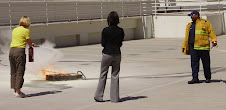
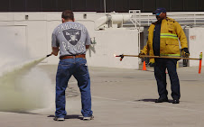
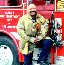
Living in Los Angeles County all of my 45 years and being a firefighter/paramedic for over 17 years, I feel deep in my heart the need for my community to prepare ourselves for disaster. When I say disaster, I do not only mean earthquake, but a range of disasters starting with man made (terrorist) to technological (computer, ATM, hacker threat), Biological and natural. The purpose for me starting this blog spot is to give a voice to a grass roots movement to mobilize and wake up my community with frank and honest dialog. I will post information, share news and promote the message of community preparedness. I hope you enjoy your time here, but more importantly, I hope you read something that will inspire you to prepare your home and neighborhood as well as promote to others the need to "hope for the best, but prepare for the worst". I do not know where this will go, but I do know that it starts with one. Right here and right now, that one is me.
Subscribe to:
Posts (Atom)